Résultats de la recherche : "Tanguy (géomètre en chef), Graff (géomètre)" 15 résultats
Notice d'illustration
IVR53_20135615013NUCB
|
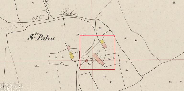
Ancienne ferme, Saint-Pabu de Bragou (Pluherlin)
Saint-Pabu de Bragou. Extrait du plan cadastral de 1840 (AD Morbihan, 3 P 217)
Notice d'illustration
IVR53_20135615004NUCB
|
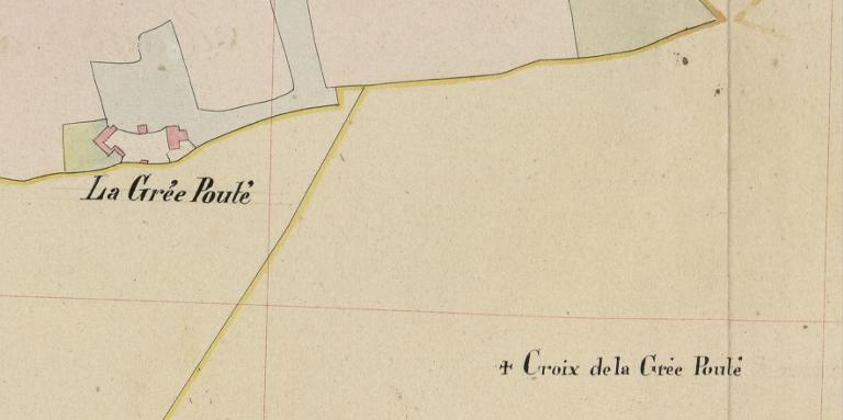
Croix de chemin, dite Croix de la Grée Pouté, (Pluherlin)
La Grée Pouté. Extrait du tableau d'assemblage du plan cadastral de 1840 (AD Morbihan, 3 P 217)
Notice d'illustration
IVR53_20135615005NUCB
|
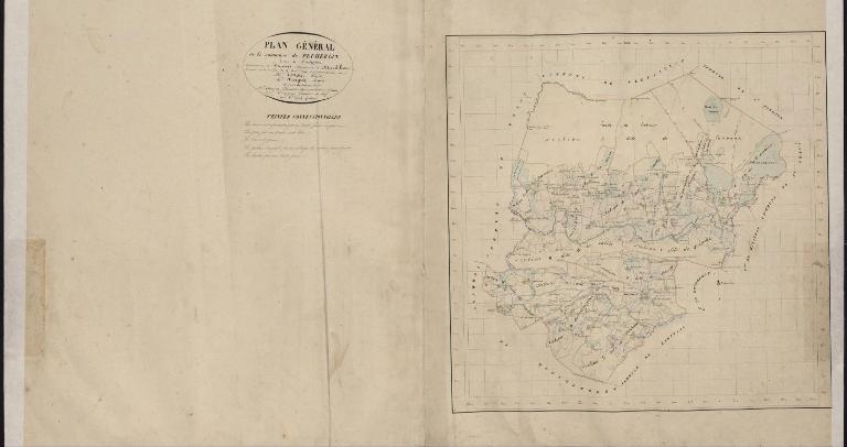
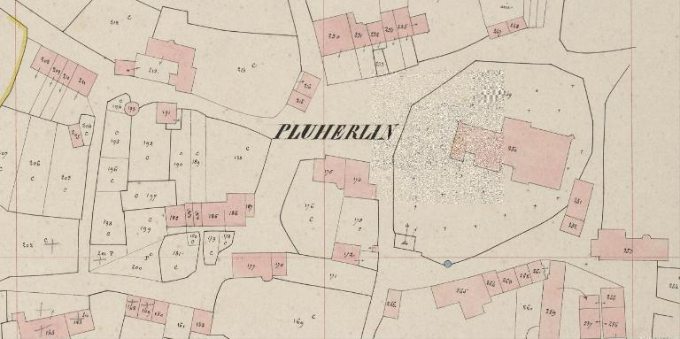
Présentation de la commune de Pluherlin
Tableau d'assemblage de Pluherlin en 1840 (AD Morbihan, 3 P 217)
Notice d'illustration
IVR53_20135615091NUCB
|
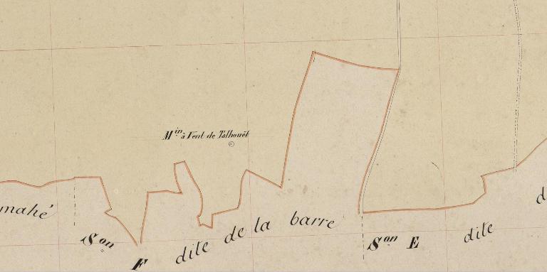
Ancien moulin à vent, dit le Moulin Rougé ou Moulin de Talhouët (Pluherlin)
Le moulin Rougé, anciennement appelé "le moulin du Talhouët". Extrait du plan cadastral de 1840 (AD Morbihan 3 P 217)
Notice d'illustration
IVR53_20135616032NUCB
|
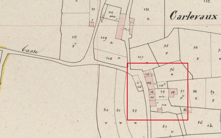
Ferme, Carlevaux (Pluherlin)
Carlevaux. Extrait du plan cadastral de 1840 (AD Morbihan, 3 P 217)
Tanguy (géomètre en chef), Graff (géomètre)
Tanguy (géomètre en chef), Graff (géomètre)
Cliquez pour effectuer une recherche sur cette personne.
Notice d'illustration
IVR53_20135615000NUCB
|
Église paroissiale Saint-Gentien, le Bourg (Pluherlin)
Le bourg. Extrait du plan cadastral de 1840 (A.D Morbihan 3 P 217)
Notice d'illustration
IVR53_20135615170NUCA
Maison, Le Gachot (Pluherlin)
Plan cadastral 1840, section C2 (AD Morbihan, 3P 147)
Notice d'illustration
IVR53_20135615063NUCA
|
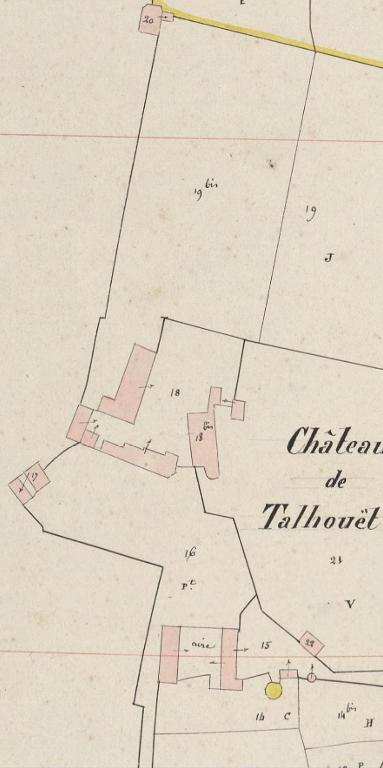
Château de Talhouët (Pluherlin)
Le Talhouët. Extrait du plan cadastral de 1840 (AD Morbihan, 3 P 217)
Archives départementales du Morbihan
Archives départementales du Morbihan
Cliquez pour effectuer une recherche sur cette personne.
Notice d'illustration
IVR53_20135615154NUCB
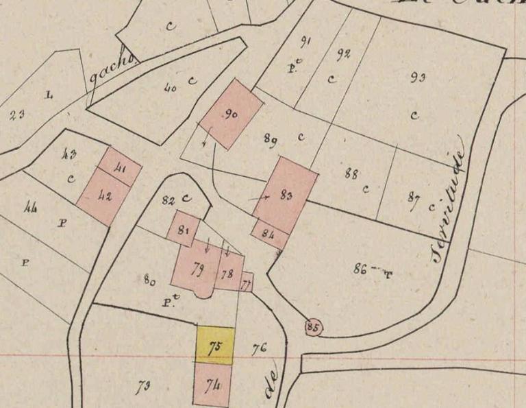
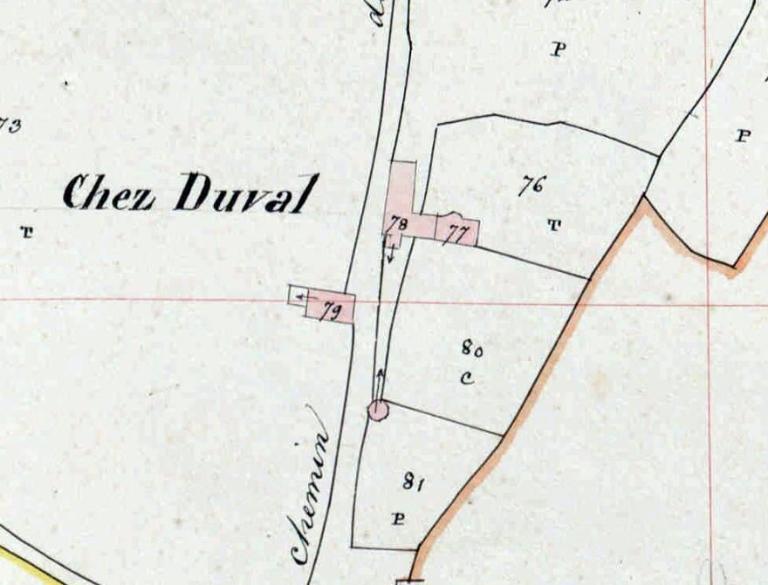
Ancienne métairie, Chez Duval (Pluherlin)
Plan cadastral 1840, section F1 (AD Morbihan, 3P 217)
Notice d'illustration
IVR53_20135615044NUCB
|
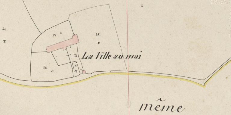
Ferme, La Ville au May (Pluherlin)
La Ville au Mai. Extrait du plan cadastral de 1840 (AD Morbihan)
Archives départementales du Morbihan
Archives départementales du Morbihan
Cliquez pour effectuer une recherche sur cette personne.
Notice d'illustration
IVR53_20135615153NUCB
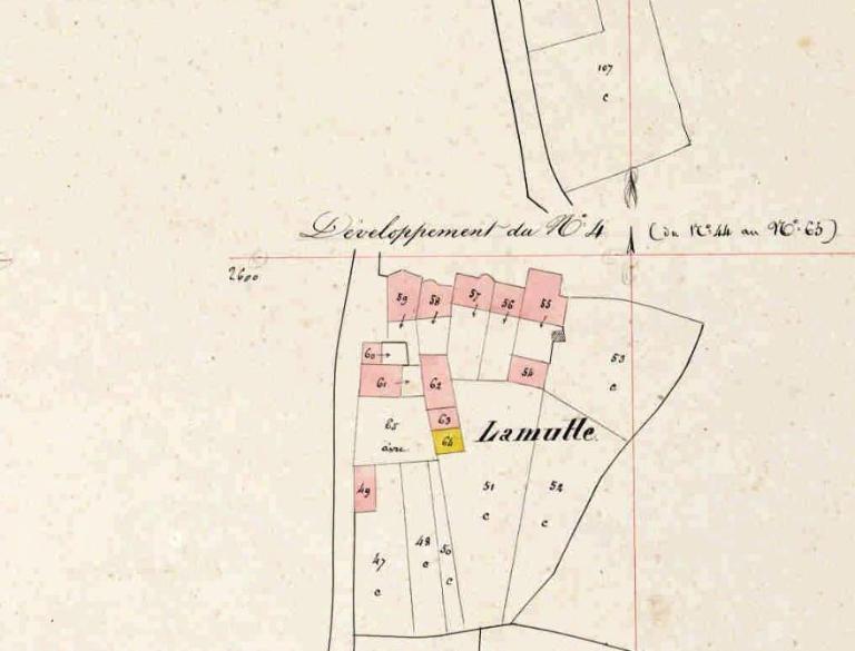
Ferme, la Mutte (Pluherlin)
La Mutte. plan cadastral 1840, section F1 (AD Morbihan, 3P 217)
Notice d'illustration
IVR53_20135615003NUCB
|
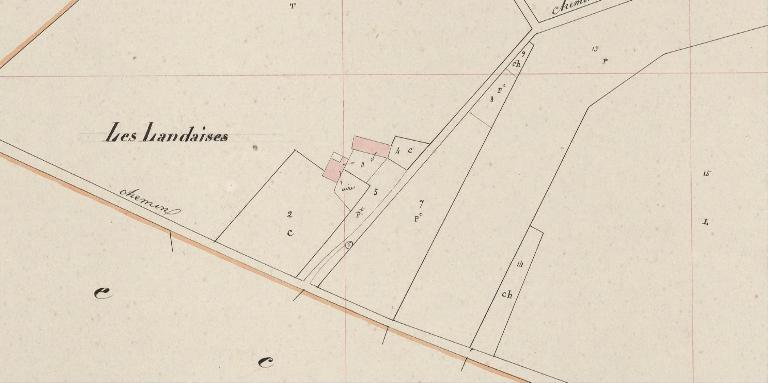
Ferme, les Landaises (Pluherlin)
Les Landaises. Extrait du plan cadastral de 1840 (AD Morbihan, 3 P 217)
Archives départementales du Morbihan
Archives départementales du Morbihan
Cliquez pour effectuer une recherche sur cette personne.
Notice d'illustration
IVR53_20135651131NUCA
|
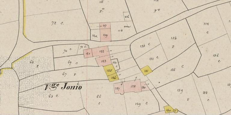
Ferme, Le Jonio (Pluherlin)
Plan cadastral 1840, section D3 : Le jonio, parcelles 127, 128, 130 (AD Morbihan, 3P 217/16)
Tanguy (géomètre en chef), Graff (géomètre)
Tanguy (géomètre en chef), Graff (géomètre)
Cliquez pour effectuer une recherche sur cette personne.
Notice d'illustration
IVR53_20135615151NUCB
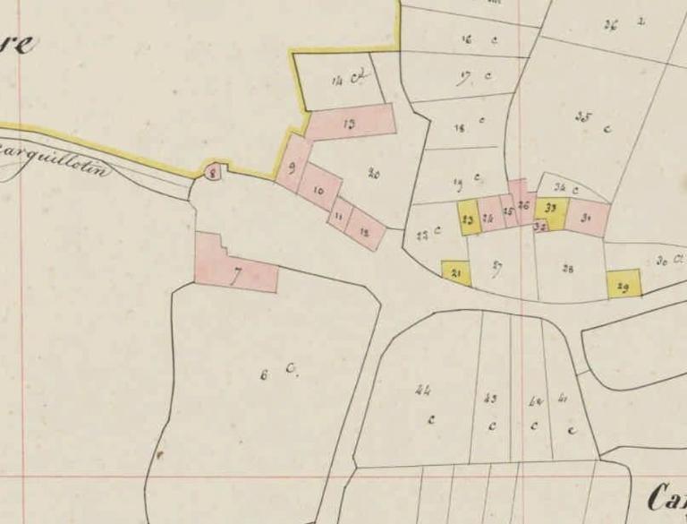
Ferme, Carguillotin (Pluherlin)
Extrait du plan cadastral de 1840 (AD Morbihan, 3 P 217)
Notice d'illustration
IVR53_20135615062NUCB
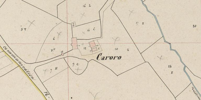
Ancien manoir, Caroro (Pluherlin)
Caroro. Extrait du plan cadastral de 1840, section N1 (AD Morbihan, 3 P 217/53)